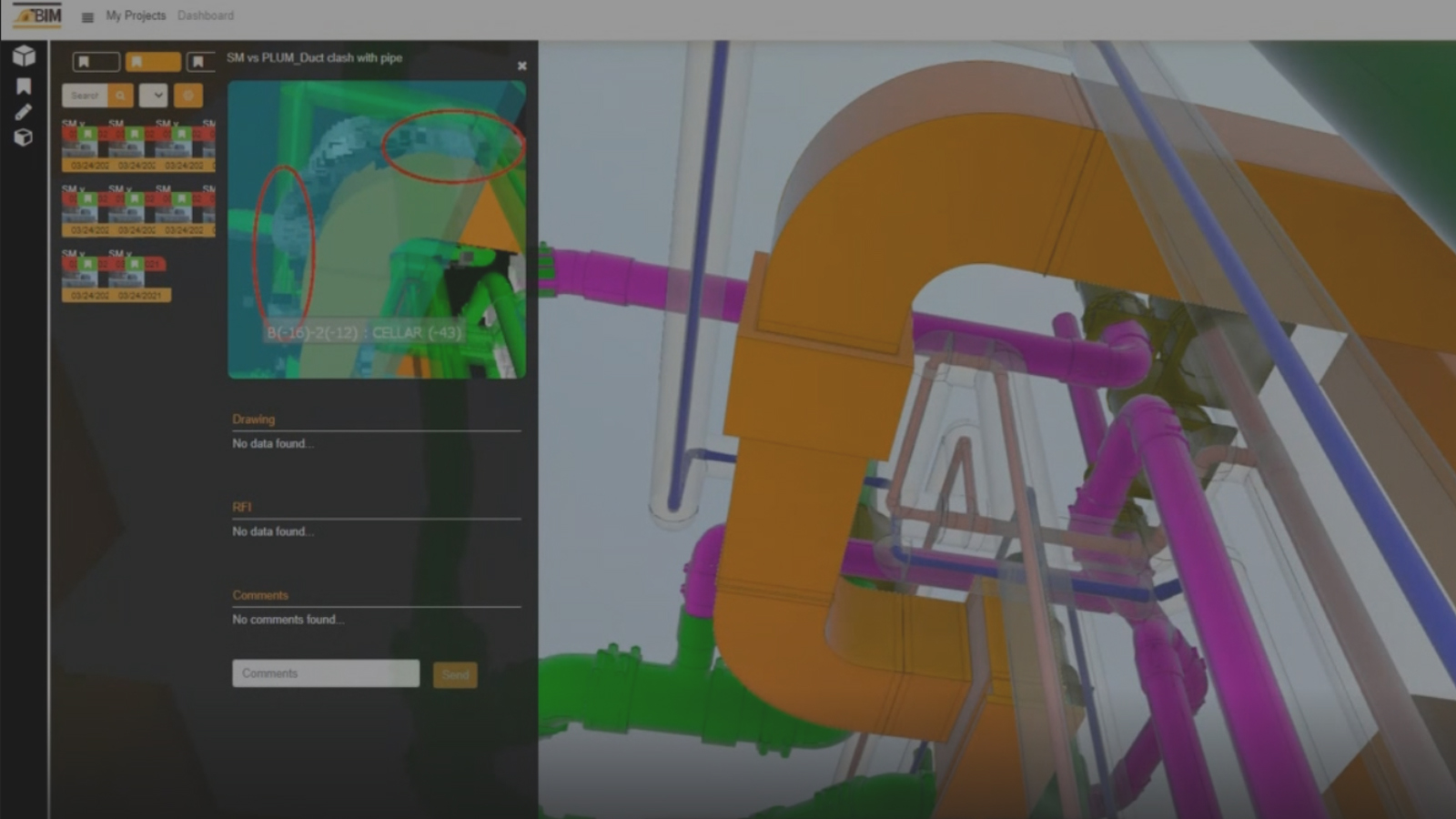
New construction, facilities management, and renovation projects are frequently bottled-up by insufficient and inaccurate field data. 3D Laser Scanning integrated with accurate site documentation enables architects, contractors, engineers, and facilities managers to realize challenging projects. BIMe delivers comprehensive and accurate data visualization to connect 2D plans & point cloud models with photo documentation, manage project risks by documentation as-built conditions, link RFI’s to point clouds, and more.


With a team of certified professionals and high-performance virtual construction tools, project
stakeholders have the power to visualize the present, and what needs to be perceived next with pinpoint
accuracy. BIMe provides end-to-end services & tools to document every building component and
compare it with point clouds and 3D BIM models. Instead of looking through outdated field documents or
2D plans, project stakeholders can leverage real-time conditions and visualization.
360 Timeline, Compare 2 images of the same room side-by-side to analyze the progress between the 2 pictures(dates). Review the progress of each location over a period of time.
Risk Management, Take periodic rough-in pictures, especially before close-in to document your systems as-built locations this helps your client with future changes managing critical issues, and documenting as-built conditions.

Enhanced building performance based on updated project documentation


New construction, facilities management, and renovation projects are frequently bottled-up by insufficient and inaccurate field data. 3D Laser Scanning integrated with accurate site documentation enables architects, contractors, engineers, and facilities managers to realize challenging projects. BIMe delivers comprehensive and accurate data visualization to connect 2D plans & point cloud models with photo documentation, manage project risks by documentation as-built conditions, link RFI’s to point clouds, and more.

Complex and large-scale construction projects demand a connected process and technology ecosystem that connects Point Cloud deliverables, BIM applications, and onsite data. Mere 3D laser scanning solutions and services aren’t cutting it, and require added layers of data collection, analysis, and presentation tools to connect tie-in-points. BIMe gives designers and engineers the power to visualize constructability, locate accurate model geometry, streamline reviews, and facilitate an interference-free installation.


