Reading Time: 5 minutes
Getting accurate site data shouldn’t be complicated. But it often is.
Outdated drawings, conflicting measurements, and scattered field photos cause delays and confusion across construction and renovation projects. Architects ask for one thing. The field delivers something else. Facility teams inherit incomplete records. And project teams spend more time verifying than building.
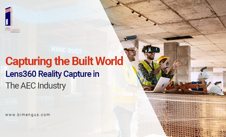
At BIM Eng US, we solve this problem with reality capture. Not the watered-down kind that just gives you a few scans and photos, but a full service that combines 3D laser scanning, BIM integration, and 360° visual documentation. The result? A crystal clear and real-time view of what exists in place and how it compares to what should be there.
Let’s break it.
Work Smarter, Not Harder
iFieldSmart empowers your team with AI-driven efficiency to simplify scheduling, boost collaboration, and keep projects on track.
Schedule a MeetingWhat Is Reality Capture, And Why It Matters
Reality capture means exactly what it sounds like: you capture what’s physically there in the built world and turn it into usable digital data.
We do this using high-precision 3D laser scanners, 360-degree cameras, and tools like Lens360 that let you walk a virtual jobsite from anywhere. No guesswork. No assumptions. Just a complete digital replica of the physical space.
Why does this matter? Because field conditions change constantly. Walls get framed, pipes get moved, and installations shift sometimes slightly, sometimes dramatically. If your drawings and BIM models don’t reflect those changes, you’re building on a lie.
We help you build on facts.
What BIM Eng US Delivers
We don’t just hand over scans and call it a day. Our team documents every detail and connects the dots between scans, models, and project decisions. Here’s what you get:
1. As-Built Documentation That Matches Reality
We capture exact measurements using 3D laser scanning and photo documentation. Then, we link this data directly to your BIM model. So when you open your Revit file or check a plan, you’re not working off assumptions; you’re seeing what’s there.
It means fewer RFIs, fewer change orders, and smoother coordination.
2. 360° Site Views with Lens360
With Lens360, you can walk the jobsite virtually. Every capture tells a story: what changed, what progressed, what’s out of place. You compare two images of the same room side-by-side and instantly understand what happened between two dates.
You also get timeline documentation, rough-in tracking, pre-close-in verification, and a full photographic history for future maintenance or disputes.
This isn’t extra work. It’s insurance.
3. Scan-to-BIM for Renovation and Facility Projects
Let’s say you’re retrofitting an old hospital or expanding a commercial building. The existing drawings might be wrong or missing. We scan the space, convert it into a point cloud, and build a BIM model from that data. Now your design team starts with facts, not fiction.
It shortens design cycles. It prevents site surprises. And it keeps your contractors from improvising in the field.
4. Progress Tracking That’s Useful
Weekly 360° captures allow you to track jobsite progress without setting foot on-site. You match visuals with your BIM model to confirm what’s been done and what’s pending. No guessing. No calls asking, “Did they pour that slab yet?”
You know. You see it.
Who This Helps
Reality capture helps everyone in the AEC chain, but each role benefits differently.
- Architects avoid rework by designing with real site conditions from day one.
- Contractors reduce RFIs and change orders because the model reflects reality.
- Facility managers inherit accurate records for future maintenance or renovations.
- Owners get visibility into their investment every step of the way.
We’re not just making life easier for one team; we’re aligning the whole project around a single source of truth.
More Than Just Scans: Data You Can Use
Scanning by itself isn’t enough. You need tools and structure to turn raw data into something useful. That’s where our full workflow comes in.
We tag images. We link RFIs. We connect field documentation to your project management platform. We provide real-time access to everyone on the team, whether they’re on-site or remote.
If a problem comes up later, an HVAC conflict, a wall penetration, or a missing sleeve, you don’t search through folders. You open Lens360, go to the location, and see exactly what happened, when, and who was involved.
You stop guessing. You act with confidence.
Risk Management You Can Rely On
Think of every point you scan and every image you capture as a piece of risk protection.
- You take rough-in photos before the walls close up? You’re protected.
- Do you track change conditions visually during construction? You’re covered.
- You capture MEP installs in 360°? You’ve documented every decision.
When disputes happen or warranties are questioned, that data becomes your best defence.
Final Thought: Stop Building Blind
Too many teams still rely on guesswork. Or worse, they waste hours confirming what should have already been verified. That doesn’t scale. And it doesn’t serve anyone, least of all the owner paying for it.
Reality capture done right gives you something every project needs: clarity.
It gives you the accurate site data, current, and tied to your drawings, models, and decisions. And when you combine it with tools like Lens360 and scan-to-BIM workflows, you do not keep up with the job; you stay ahead of it.
So if you are tired of working in the dark, we’re ready to help you see the whole picture.