Reading Time: 4 minutes
Designers often begin designing a building long before they open a single model. It begins with local conditions, existing structures, and positional relations of the environment. But very often, this information comes through rough surveys, static photos, or drawings that do not reflect the current state of the site. This is where reality capture makes a difference. Instead of working with outdated assumptions or documentation, architects now have access to representations rich in highly accurate data from the built environment. This means that we can base decisions on what is there, not what may be there.
What exactly is reality capture?
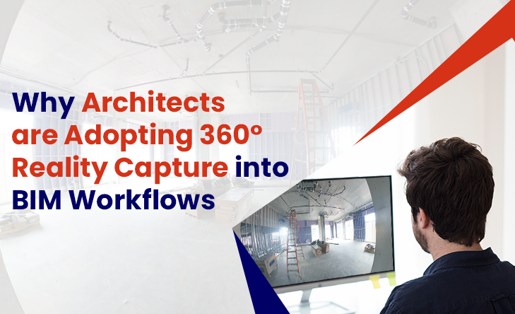
Reality capture is the method of digitizing real-world environments through tools such as 3D laser scanners and 360° cameras. The result, in the form of a point cloud or geotagged images, provides a precise visual and spatial representation of a physical location. It becomes a basis for architects. It delivers context for design decisions and highlights constraints that aren’t obvious from plans or early site visits. The outcome: less surprise, improved consistency between design intent and site conditions, and greater control over project evolution.
Where BIM fits in
Building Information Modelling (BIM) enables the creation of detailed digital models that encompass geometry, materials, spatial data, and more. It is a collaborative environment in which architects, engineers, and other stakeholders can work together in a centralized model.
Work Smarter, Not Harder
iFieldSmart empowers your team with AI-driven efficiency to simplify scheduling, boost collaboration, and keep projects on track.
Schedule a MeetingWhen combined with reality capture, BIM becomes even more useful. Architects can reference laser scans or 360° imagery as they design. They can verify dimensions, understand spatial relationships, and model around what’s already in place.
Instead of designing in isolation, architects are creating with the full picture.
A closer look at design accuracy
Design accuracy isn’t just about getting measurements right. It is about reducing ambiguity, clarifying the intention, and minimizing downstream changes. The more accurate your design is from the beginning, the fewer reviews you will need to do later.
When you introduce reality capture into early-stage design, you bring in data that grounds the entire process. You can:
- Avoid clashes with existing structures
- Understand mechanical or structural limitations early
- Validate spatial relationships before documentation begins
This leads to better decisions not because of advanced tools, but because you’re working with better information.
Early-stage feasibility without assumptions
Site feasibility is a major concern at the beginning of any project. How much usable space is available? Are there unexpected constraints? Will the proposed design work within zoning, structural, or access limitations?
Using reality capture, architects can analyze real-world site conditions before investing significant time in modeling or schematic design. This information makes feasibility checks faster, more understandable, and more based on reality.
It also minimizes the back-and-forth among stakeholders that requires the visual context to understand the limitations or possibilities of a site.
Visual clarity for everyone involved
Design is a collaborative process. Architects work with clients, consultants, engineers, contractors, and local authorities. The more evident the project context, the easier the process is.
360° visuals from reality capture provide a shared reference point. Everyone can “view” the site even if they’ve never been there. It improves communication, reduces confusion, and helps non-designers understand decisions without replacing architectural drawings.
It’s not about replacing architectural drawings. It’s about giving them a clearer foundation.
Track what’s changed.
Projects evolve. Site conditions change. Documentation updates. Capturing these changes visually and accurately is important, especially for projects with long timelines or complicated phasing.
Reality capture tools allow architects to compare site conditions over time. You can view what a space looked like before demolition, after rough-in, or just before closeout. This visual archive supports better documentation and reduces the likelihood of missed details.
So why are architects using this now?
Because the tools are more accessible. Because project timelines are tighter. Because expectations around accuracy and communication are higher.
Reality capture isn’t about replacing the architect’s skill or judgment. It’s about adding another layer of information, one that’s grounded in what’s real, not what’s assumed.
Combined with BIM, it is an effective element of the design process. One that supports clarity, reduces uncertainty, and lets design teams work with more confidence.
Final thoughts
Architects aren’t using reality capture and BIM because they’re trendy. It naturally fits with the way design is changing, becoming more collaborative, data-driven, and about solving real-world problems before they become construction issues.
Design always starts with a question: what are we working with?
Reality capture gives a better answer. And that makes a better design possible.